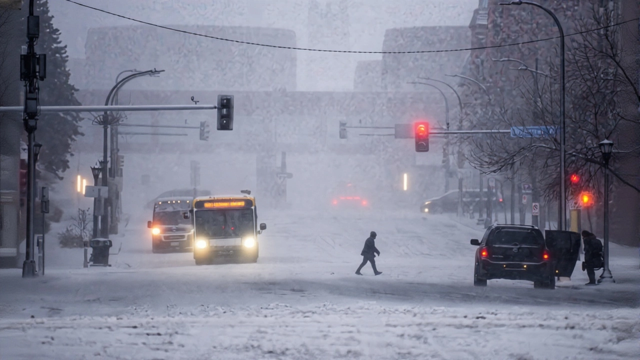
A brutal winter storm slammed the Upper Midwest on Tuesday, November 21, 2023, turning Thanksgiving travel into a nightmare for millions as snowfall rates exceeded 1 inch per hour in some areas and winds howled at 45 mph, creating near-zero visibility and whiteout conditions. The National Weather Service issued winter storm warnings across North Dakota, Minnesota, South Dakota, Wisconsin, and Michigan—regions already bracing for one of the heaviest November snowfalls in decades. With Grand Forks expecting 6 inches and Minneapolis-St. Paul on track for 5 to 8 inches, forecasters warned that areas near the Canadian border could see 20 to 30 inches by Wednesday morning. The timing couldn’t be worse: this storm rolled in during the busiest travel window of the year, when over 55 million Americans hit the road and skies for Thanksgiving.
Two Storms, One Nightmare
The weather system wasn’t just one big snow cloud—it was two. The first, a wet low-pressure system, dumped rain across the Ohio Valley on Tuesday before sliding into the Northeast. But the real menace was the second: a powerful Arctic blast sweeping down from Canada, carving a path from the Northern Plains through the Great Lakes. This one brought not just snow, but wind—ferocious, bone-chilling wind. In the Twin Cities, the National Weather Service office in Chanhassen, Minnesota, reported gusts up to 45 mph, enough to trigger blizzard conditions. By 6 a.m. CT on Wednesday, snowdrifts were already piling up against cars and fences, and road crews were struggling to keep up.
“It’s not just the snow,” said Nikki Nolan, CBS News meteorologist, during a live update Tuesday morning. “It’s the wind. When you combine 20 inches of snow with 40-mile-per-hour gusts, you don’t just get a snowy day—you get a travel blackout.” In Grand Forks, where the warning remained active through Tuesday night, drivers reported cars stalled on I-29, and snowplows were stuck in drifts taller than their cabs.
Travel Chaos Across Key Corridors
Major highways became parking lots. The I-90 corridor from Sioux Falls to Rochester, the I-94 stretch from Fargo to Milwaukee, and I-29 through North Dakota all saw multiple accidents and closures by midday Tuesday. State DOTs in Minnesota and Wisconsin activated emergency response teams, but plows couldn’t keep pace. In Wisconsin, the Department of Transportation advised all travelers to “stay off the roads unless absolutely necessary.”
Airports fared no better. The Minneapolis-St. Paul International Airport canceled over 300 flights by Tuesday evening, with another 500 delayed. Chicago O’Hare, though outside the heaviest snow band, saw dozens of cancellations as planes from the north were grounded. Duluth, Fargo, and Pierre airports reported similar chaos. Families were stranded. Some travelers spent hours in terminals, sleeping on benches with carry-ons as their only blankets.
Why This Storm Is So Unusual
November snowfall in the Upper Midwest isn’t unheard of—but 20 to 30 inches? That’s rare. Historical data from the National Oceanic and Atmospheric Administration shows that most November storms in this region bring 4 to 8 inches. The last time Grand Forks saw more than 20 inches in November was 2014. And the wind? That’s the kicker. Wind chills in the Twin Cities dropped to 15 below zero by Wednesday morning. People weren’t just fighting snow—they were fighting frostbite.
“This isn’t just a snowstorm,” said Dr. Elena Ruiz, a climatologist at the University of Minnesota. “It’s a textbook example of what happens when a strong polar vortex dips farther south than usual. We’re seeing climate patterns shift—earlier, harder winters are becoming more common.”
What Comes Next
By Wednesday afternoon, the snow was tapering off, but the danger wasn’t over. The real challenge now is thawing and refreezing. Temperatures are expected to dip below zero again Thursday night, turning slush into ice sheets on roads and sidewalks. Power outages are already reported in rural Minnesota and Wisconsin, where downed trees and ice-laden branches snapped utility lines. Emergency shelters opened in Fargo, Grand Forks, and St. Paul for those without heat.
For the millions stuck in transit, the wait continues. Some are calling family from airport lounges, others are sleeping in their cars. A woman in Duluth told a local reporter she’d been waiting since 7 a.m. Tuesday for a flight to Detroit. “I just want to hug my kids,” she said. “I don’t care if it’s midnight. I’ll wait.”
What You Need to Know
- Winter storm warnings remain active through Wednesday, November 22, 2023, for parts of North Dakota, Minnesota, Wisconsin, Michigan, and South Dakota.
- Grand Forks received 6 inches of snow with 35 mph winds; Twin Cities saw 5–8 inches and blizzard conditions.
- Over 800 flights canceled or delayed across five major airports as of Wednesday morning.
- Interstates I-29, I-90, and I-94 experienced major closures and accidents.
- Temperatures will remain dangerously low through the weekend, with wind chills dipping below zero.
Frequently Asked Questions
How does this storm compare to past Thanksgiving travel disruptions?
This is among the worst pre-Thanksgiving storms in the last 15 years. The last comparable event was in 2014, when a similar Arctic surge dumped 24 inches on Grand Forks and closed I-29 for over 30 hours. But this storm’s combination of heavy snow, high winds, and timing—right when travel peaks—makes it more disruptive. In 2014, fewer people flew; today, over 55 million Americans travel for Thanksgiving.
Who’s most affected by this storm?
Rural communities in northern Minnesota, eastern North Dakota, and western Wisconsin are hit hardest—not just by snow, but by power outages and limited emergency services. Travelers heading from Chicago to Minneapolis or from Detroit to Milwaukee are stranded. Elderly residents without reliable heating are at risk, and many school districts canceled classes Wednesday as a precaution.
What’s the timeline for recovery?
Snowfall should stop by Thursday morning, but cleanup will take days. Plows are overwhelmed, and temperatures won’t rise above freezing until Saturday. Ice on roads could persist into next week. Airports expect to resume normal operations by Friday, but delays will linger as crews clear runways and de-ice planes. The worst of the travel chaos is over, but the aftermath is just beginning.
Are there any safety tips for those still on the road?
If you must drive, keep your gas tank at least half full, carry blankets, water, and non-perishable food, and avoid using cruise control on icy roads. Stay off roads if visibility is under a quarter-mile. Many state DOTs have live road cams—check them before leaving. And if your car stalls, stay inside, run the engine sparingly for heat, and tie a bright cloth to the antenna so rescuers can spot you.
Why did the Twin Cities get more snow than expected?
The initial rainfall Monday night created a warm layer that suppressed snowfall early Tuesday. But as cold air surged in, that moisture suddenly froze, triggering explosive snow growth. The National Weather Service revised forecasts upward by 30% by noon Tuesday because the storm’s moisture content was higher than predicted. It’s a reminder: winter storms can intensify rapidly when cold air meets lingering moisture.
Is climate change making storms like this more common?
Scientists say yes. While individual storms can’t be blamed solely on climate change, the pattern is clear: warmer Arctic Ocean temperatures are weakening the polar vortex, allowing cold air to spill farther south more frequently. The result? More extreme winter events in places like Minnesota and Wisconsin—even as global averages rise. This storm isn’t an anomaly. It’s a sign of what’s becoming the new normal.


